-
· by Roger Keller · in Research, Teaching and studying Community-led Open Scholarship: Two examples from GIUZ
Read MoreEngaging with various stakeholders to find creative solutions through collaborative pathways, that’s the basis of our research and teaching in the Space, Nature and Society group (SNS). We are convinced that working towards transformative change requires collaboration across academic disciplines and with stakeholders from outside academia.
-
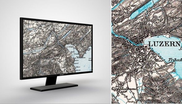
· by Monika Kriemler Fritsche · in History, What's new Die Dufourkarte: Meisterwerk der Kartographie und Zeugnis einer werdenden Nation
Read MoreIm Jahr 1848 erhielt die Schweiz eine neue Verfassung. Sie legte den Grundstein für den modernen Bundesstaat. Graphisch abgebildet wurde dies mit der Dufourkarte, dem ersten amtlichen Kartenwerk. Zum Jubiläum «175 Jahre Bundesverfassung» stellt das Bundesamt für Landestopografie swisstopo die Erstausgabe der Dufourkarte digital zur Verfügung. Read this in English 🇬🇧
-

· by Lars Weidinger, Peppino Müller · in Teaching and studying PCB, Drohnen und der emsige Tannenhäher: Eine Exkursion in den Schweizerischen Nationalpark
Read MoreAnfang September fand im Rahmen der Lehrveranstaltung GEO 715 eine Exkursion zum Thema «GIS-Einsatz in Schutzgebieten» statt. Wir wanderten durch den Schweizerischen Nationalpark und erhielten vielfältige Einblicke in die Forschung und Anwendung von geografischen Informationssystemen im Kontext des Nationalparks.
-
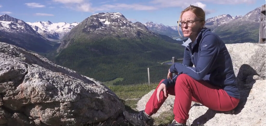
· by Isabelle Gärtner-Roer · in Research, What's new «Das Eis war lange der Klebstoff, der alles zusammengehalten hat»
Read MoreDie faszinierende Hochgebirgslandschaft des Oberengadins besticht durch liebliche Seen, breite Täler und schroffe Berggipfel. Diese Landschaftsformen zeigen die Geschichte ihrer Vergletscherung an. Doch auch der Einfluss der Klimaveränderung lässt sich an vielen Orten deutlich erkennen – nicht nur für uns Geomorpholog:innen!
-

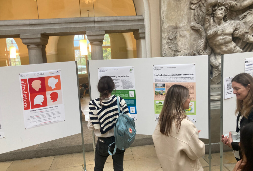
· by Fabio Eberhard, Leonora Seiler, Mirjam Steiger · in Teaching and studying Orientierung, Inspiration und Vernetzung: Das erste nationale Berufspodium der Geographie
Read MoreAm Donnerstag, 12. Oktober 2023 trafen sich rund 140 Studierende aus Zürich, Bern, Basel und Neuchâtel zum ersten nationalen Berufspodium der Geographie an der Universität Zürich. Der Anlass wurde in Zusammenarbeit mit den Fachvereinen der verschiedenen Unis auf die Beine gestellt.
-
· by Hanna Hilbrandt · in Research, What's new New Podcast Series: The Urban Life of Property
Read More“The Urban Life of Property: Thinking about Appropriation, Dispossession and Expropriation in Theory and Practice” is a new podcast series that explores new conceptions of property.
-
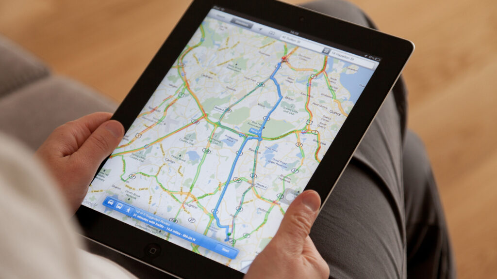
· by Tumasch Reichenbacher · in Research Personalisierte Kartenapps
Read MoreDigitale Kartenapps spielen in der alltäglichen Mobilität eine grosse Rolle. Die Digitalisierung kann dazu beitragen, mobile Karten individueller zu gestalten und Mobilität so inklusiver zu machen.
-
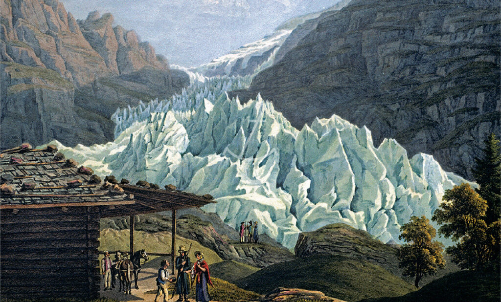
· by Samuel U. Nussbaumer, Christian Rohr, Céline Walker, Tamara T. Widmer, Heinz J. Zumbühl · in History, Research, Sustainability Mit historischen Gletscherbildern frühere Gletscherstände rekonstruieren
Read MoreGletscher sind hervorragende Klimaindikatoren. Historische Bilder zeigen frühere Gletscherschwankungen besonders eindrucksvoll. Nun wurden über 300 Bilddarstellungen in die klimahistorische Datenbank Euro-Climhist integriert.
-
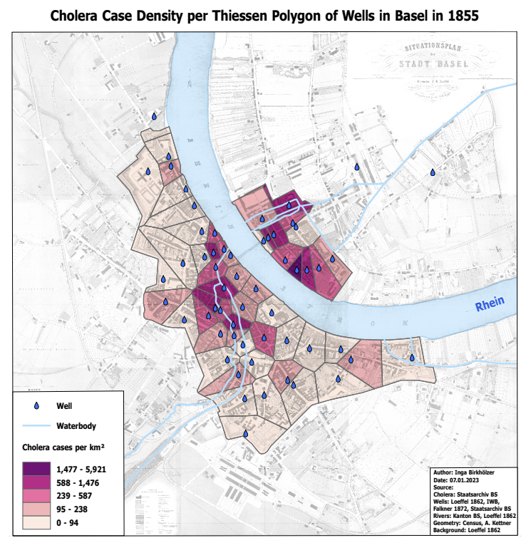
· by Katia Soland · in Master's and PhD students projects Cholera 1855 in Basel: Between History, Epidemiology and Geographic Visualisation
Read MoreIn 1854, Dr. John Snow creates a map of cholera cases in London’s Soho district. He can thus show that the disease is transmitted through contaminated water. In her Master’s thesis, Inga Birkhölzer investigated what can be extracted today from the cholera figures of 1855 in Basel using geographical visualisation.
-

· by Hanna Hilbrandt · in Teaching and studying Stadt ohne Papiere
Read MoreWie finden Menschen ohne Aufenthaltspapiere Wohnraum? Welche Bleibestrategien verfolgen sie, um diesen Wohnraum zu halten? Und durch welche legalen Grauzonen navigieren sie dabei? Diese und andere Fragen zur prekären Wohnsituation von Sans-Papiers untersuchten Studierende im Frühlingssemester 2023.