35 Beiträge in Kategorie: Research
“Thermal Lens”: Explaining thermal remote sensing in a podcast series
Identifying urban heat islands or monitoring plant health from space are just two examples of applications of thermal remote sensing. In this new podcast series, experts discuss topics ranging from satellite mission design and products from both traditional and new space perspectives, and applications in agronomy and urban planning and more.
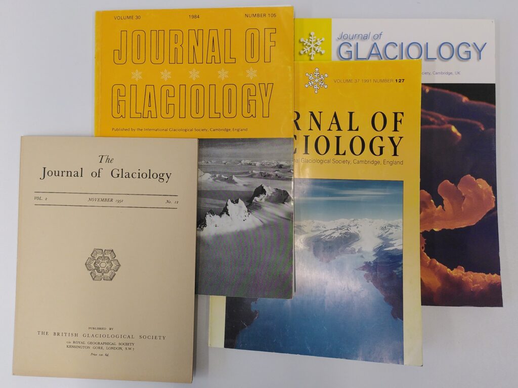
More than 70 years of glacier research in one room
The library of the World Glacier Monitoring Service (WGMS) offers a rich collection of glaciology books and journals, including an almost complete Journal of Glaciology series dating back to 1947. Visit us on Campus Irchel in room Y25-H-84 and immerse yourself in decades of glaciological research.

“Every tenth of a degree counts”
The One Planet Polar Summit in Paris brought together representatives from science, business, civil society, and politics from more than 40 glacier and polar countries. The aim was to share the latest findings in cryosphere and glacier research and to close the gap between science and politics in view of the climate crisis.
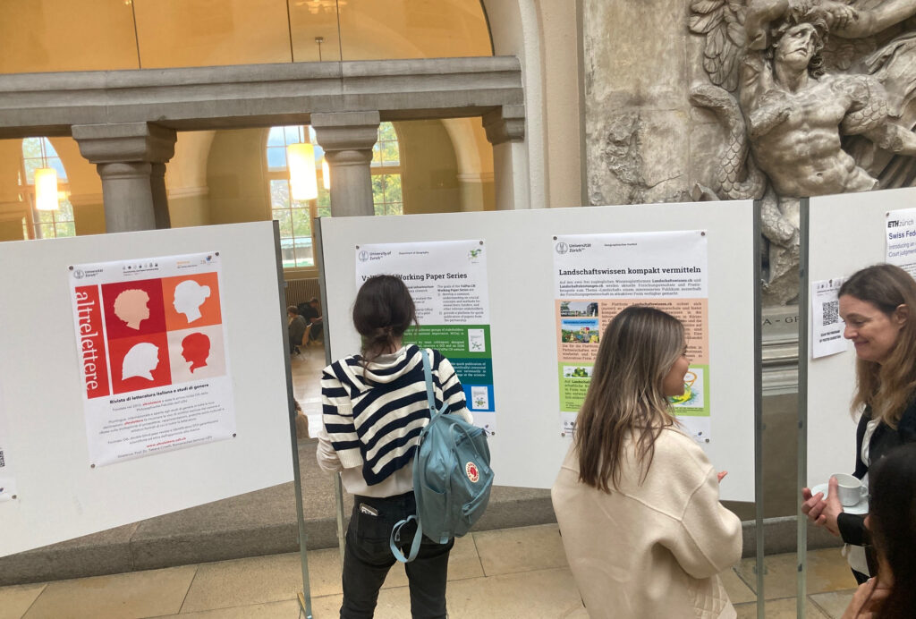
Community-led Open Scholarship: Two examples from GIUZ
Engaging with various stakeholders to find creative solutions through collaborative pathways, that’s the basis of our research and teaching in the Space, Nature and Society group (SNS). We are convinced that working towards transformative change requires collaboration across academic disciplines and with stakeholders from outside academia.
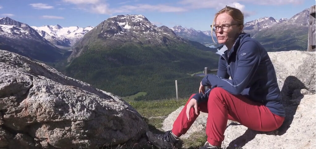
«Das Eis war lange der Klebstoff, der alles zusammengehalten hat»
Die faszinierende Hochgebirgslandschaft des Oberengadins besticht durch liebliche Seen, breite Täler und schroffe Berggipfel. Diese Landschaftsformen zeigen die Geschichte ihrer Vergletscherung an. Doch auch der Einfluss der Klimaveränderung lässt sich an vielen Orten deutlich erkennen – nicht nur für uns Geomorpholog:innen!
New Podcast Series: The Urban Life of Property
“The Urban Life of Property: Thinking about Appropriation, Dispossession and Expropriation in Theory and Practice” is a new podcast series that explores new conceptions of property.
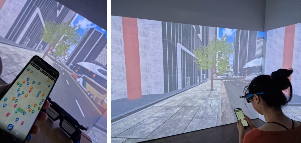
Personalisierte Kartenapps
Digitale Kartenapps spielen in der alltäglichen Mobilität eine grosse Rolle. Die Digitalisierung kann dazu beitragen, mobile Karten individueller zu gestalten und Mobilität so inklusiver zu machen.
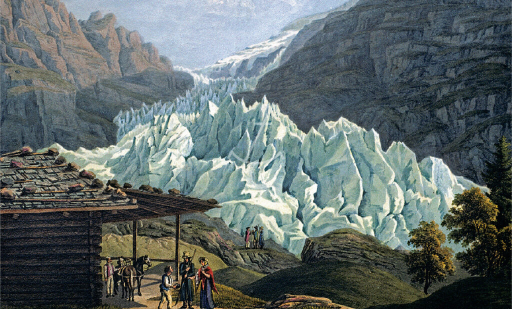
Mit historischen Gletscherbildern frühere Gletscherstände rekonstruieren
Gletscher sind hervorragende Klimaindikatoren. Historische Bilder zeigen frühere Gletscherschwankungen besonders eindrucksvoll. Nun wurden über 300 Bilddarstellungen in die klimahistorische Datenbank Euro-Climhist integriert.
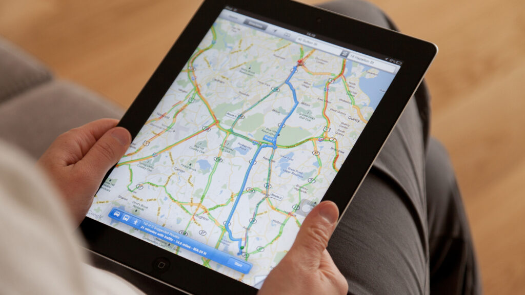
In 300m links abbiegen – Verlorene Orientierung wegen Navis
Dank GPS & Co kommen wir schneller ans Ziel. Ohne Navi haben wir immer mehr Mühe uns an unbekannten Orten zurecht zu finden. Verlieren wir unseren Orientierungssinn? Und wofür brauchen wir unser räumliches Verständnis noch?
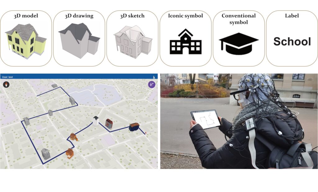
Shape the future of mobile map design: We need your help!
Have you ever used a map app on your smartphone outdoors and had to pause your activity midway because the sunlight was just too bright so you couldn’t read the map properly? Or have you ever tried finding your way to a coffee shop downtown efficiently without getting shoved by the crowds?